Research Facilities

6 of 6 facilities · laboratories, centres and equipment available for research
No facilities match your search.
Research facility

Disaster Impact & Humanitarian Need Assessment Lab
Disaster Impact & Humanitarian Need Assessment Lab

The Disaster Impact & Humanitarian Need Assessment Lab supports the research activities and practical courses on impact assessment (DIA, EIA, SEIA & SIA), risk assessment, multi-hazard risk assessment, risk evaluation and humanitarian need assessment. Moreover, this lab also supports the research themes like cost-benefit analysis and forecast-based financing.

The DIA Lab will conduct research activities mainly on the following research themes:
  • Trend analysis of the past disasters as well as their socio-economic impacts on a long term basis.
  • Disaster Impact Assessment (Environmental Impact Assessment, Strategic Environmental Impact Assessment and Social Impact Assessment)
  • Risk Assessment Methods (Quantitative Risk Assessment, event-tree analysis, risk-matrix approach and indicator-based approach), their inherent uncertainties,  multi-hazard risk assessment and risk evaluation (risk perception, risk communication and risk acceptability) strategies are crucial to decision support system and facilitate the policy-making process.
  • Capacity analysis of different government as well as non-government institutions in handling the previous disasters. Rigorous analysis wills also e carried out to find out the strength and gaps of the institutions in handling the emergency management. This will require the use of extensive SWOT analysis.
  • Damage and Loss Assessment of the disasters following ECLAC methodology. The application of the ECLAC methodology is very famous but there are limited numbers of cases in Bangladesh where this technique has been extensively used. The ECLAC method will be used and proper modifications of this method will be done before the use in the field. Moreover, OECD-DAC criteria to evaluate the response and recovery mechanism are also addressed.
  • Cost-Benefit Analysis of development projects with large environmental impact will be carried out. Most of the development projects in the country go through a weak CBA and the impact of development in creating disaster vulnerability is not analyzed. Forecast based financing (FbF) is also critical to address extended humanitarian needs.


Major Research Tools
  • UN ECLAC methodology for Disaster Damage and Loss Assessment
  • SWOT Analysis
  • Social Accounting Matrix (SAM)
  • Regression Analysis and Econometric Modelling
  • Social Surveying
  • Longer-Term Prediction and Forecasting models
  • CBA and FbF
  • ILWIS, HAZUS, INFORM, CAPRA-CRISIS and the Openquake Risk modeling tool
Research facility

Geohazard Modeling Lab

Geohazard Modeling Lab

Geohazard Lab specifically deals with Geomorphological, Geophysical and Geotechnical hazards. The aim is to better understand the processes, the factors influencing them and to find risks arising from the hazards. The variation of geologic materials and their influence on engineering design is also studied. In the context of Bangladesh, geo-hazards pose a significant threat to the population and the environment, and we expect the outcomes derived from our lab will contribute towards risk reduction and a sustainable future. Our multi-purpose lab currently has a wide range of equipment, and we are seeking to broaden the experimental capabilities in the near future.


List of already available instruments:
Geotechnical Test Instruments (standard accessories available with each of them):
  • Sieve Shaker
  • Casagrande Apparatus
  • Hydrometer
  • Direct Shear Testing System
  • Large Automated Direct Shear Testing System
  • Electro-Mechanical Dynamic/Cyclic Simple Shear Apparatus (EMDCSS)
  • Consolidation Test Apparatus
  • Triaxial Testing System
  • Pressure Meter
  • Unconfined Compression System


Geophysical Test Instruments (standard accessories available with each of them):
  • Downhole Seismic Testing System
  • MASW System (Multichannel Analysis of Surface Waves)
  • Microtremor Apparatus
  • Ground Penetrating Radar (GPR)


Licensed Software:
  • PLAXIS 3D
  • SeismoSoft
  • EZ-FRISK


Equipment procurement in the pipeline:
  • Mechanical Proctor Test Instrument (Standard and Modified)
  • Permeability (Falling Head) Testing Equipment
  • Density Testing Equipment  (In-situ test)
  • Dynamic Plate Load test Equipment
Electrical Resistivity Meter (Electrical Sounding and Profiler)


Research facility

Climate Change and Environmental Pollution Lab

Climate Change and Environmental Pollution Lab

CLIMATE CHANGE:

  • Essential Climatic Variables Estimation
  • Climate Modeling
  • Extreme Event Modeling
  • Climate Change Impact Study on Environment and Ecosystem
  • Climate Change Impact Assessment on urban and rural society
  • Climate change adaptation measures


ECOSYSTEM AND ENVIRONMENT MONITORING

  • FOREST MAPPING AND MONITORING
    The forest areas of the world are decreasing significantly due to numerous direct and indirect human activities. The lab uses remote sensing and on-field methods to efficiently map, monitor and predicts the changes as well as identifies the causes and possible measures to reduce the negative consequences for different areas.
  • AND ECOLOGICAL SENSITIVE ZONE MAPPING
    Bangladesh is still in a process of identifying and formulating plans to maintain sensitive and critical wetlands and ecological areas which house a large number of flora and fauna but can be much more sensitive to external pollution sources. The lab targets to improve the existing wetland and ecologically sensitive zone mapping; its trend analysis; identify the causes and possible mitigation measures.
  • AQUATIC ECOSYSTEMS STUDY
    almost uncontrolled dumping of municipal, agricultural and industrial pollutants in the water bodies have caused a catastrophic impact on the aquatic ecosystems all over the country. The lab focuses on the physical-chemical-biological parameters of the ecosystem and possible mitigation measures which are disseminated at different stakeholder level at certain intervals to ensure improvements from all levels of the society.


ENVIRONMENTAL POLLUTION

  • AIR AND WATER QUALITY; POLLUTION AND EMISSION INVENTORY
    Bangladesh, being a developing country, faces major challenges regarding air and water quality, and the laboratory aims to monitor and develop a database on the air and water quality parameters at different locations of the country. These data can be analyzed to assess different aspects, source and pathway identification and possible mitigation measures. It will help to formulate plans and policies of the government based on quantitative data and improve the air and water quality for a sustainable future.
  • AIR, WATER AND SOIL CONTAMINANTS AND TRANSPORT
    Environmental Pollution Studies is concerned about determining the level and extent of contamination in air, water and soil. It also aims to determine and describe how the contamination is transported from different spheres of the Earth
  • ENVIRONMENTAL TOXICOLOGY
    The lab also aims to describe and address adverse ecological health risks due to hazardous contaminants present in air, water and soil.
  • INDOOR AIR POLLUTION AND AMBIENCE ASSESSMENT
    Emissions from factories, industries as well as a municipal and domestic sources of air pollution i.e. Cookstoves and other biomass burnings. The lab aims to conduct and support assessment of indoor air pollution levels in residential, laboratories, and industries and closely monitor toxicity levels of different toxic gases to ensure a healthy and safe workplace as well as residences.
  • URBAN EMISSIONS INVENTORY: SUSTAINABLE TRANSPORT AND INDUSTRY
    Emissions from vehicles and different industrial zones are some of the sources of air pollution in urban areas. The Lab is dedicated in conducting researches to broaden and deepen the knowledge on the impacts of these emissions on the state of the quality of air.
  • TECHNOLOGICAL/ANTHROPOGENIC HAZARDS AND THEIR IMPACT ON THE ENVIRONMENT


PRESENT CAPACITY

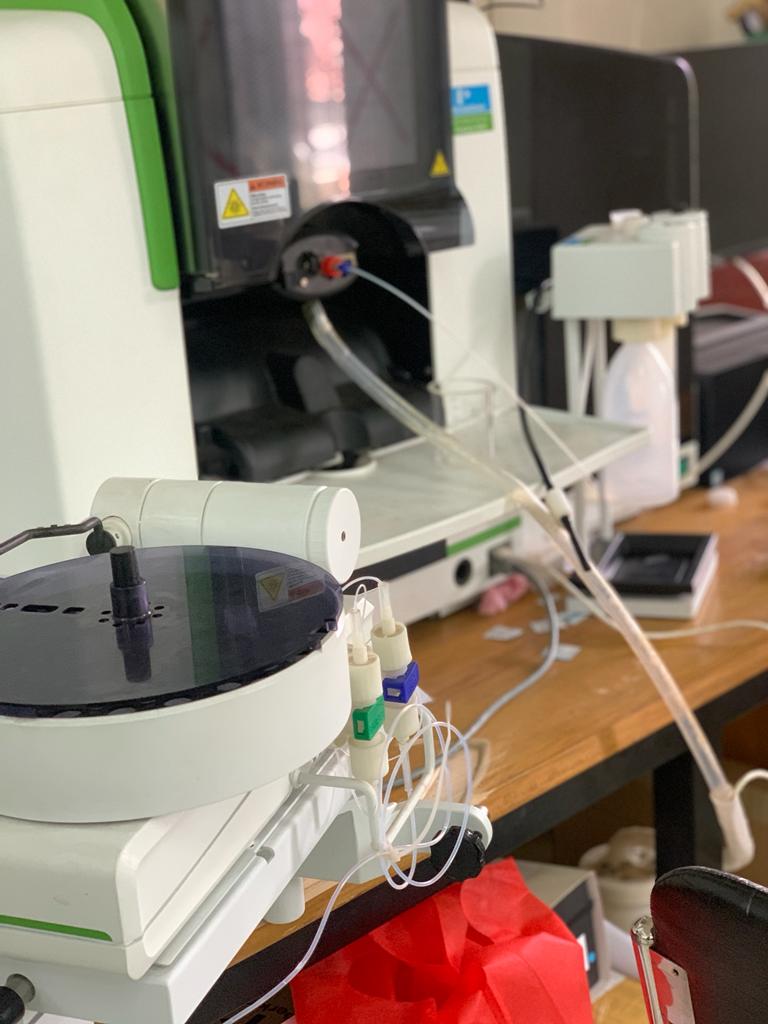
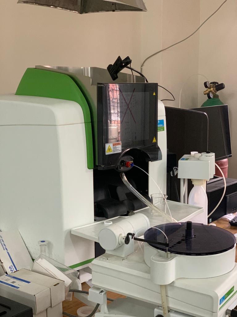
Trace Metal Detection – AAS with Flame, Furnace and Hydride Method
Ph, EC/TDS, Temperature/Cl (On site) Measurement – Multimeter
Arsenic and Chloride Field Measurement – HACH Kit

EQUIPMENT Procurement in pipeline

  • Spectrophotometer element analysis
  • Ion Chromatograph element analysis
  • Block Digestor To prepare soil samples for analysis
  • Water Distillation Unit
  • Water Deionization Unit
  • Data Loggers for water level, temperature and EC monitoring
  • Multimeter
Research facility

Hydrological and Hydro-meteorological Hazard Lab

Hydrological and Hydro-meteorological Hazard Lab

This laboratory is on its way to being established very recently and targets to study the following aspects:

  • Water (surface and subsurface) water level monitoring
  • Meteorological parameters monitoring and prediction
  • Surface water discharge and sediment transportation
  • Flood inundating mapping, flood risk and damage assessment
  • River profiling, riverbed/riverbank erosion and scouring monitoring
  • Groundwater quality, transport, contamination and remedy
  • Saline water intrusion and remedy
  • Arsenic contamination and public health impact
  • Drought monitoring
  • Rainfall induced landslide early warning, multi-hazard (landslide and flood) early warning


PRESENT CAPACITY

Trace Metal Detection – AAS with Flame, Furnace and Hydride Method
Ph, EC/TDS, Temperature/Cl (Onsite) Measurement – Multimeter
Arsenic and Chloride Field Measurement – HACH Kit
Water Level Measurement – Water Level Meter


Equipment Procurement in Pipeline

  • Spectrophotometer element analysis
  • Ion Chromatograph element analysis
  • Water Distillation Unit
  • Water Deionization Unit
  • Data Loggers for water level, temperature and EC monitoring
Research facility

Geodesy and Geoinformatics (G&G) Lab

Geodesy and Geoinformatics (G&G) Lab

The department has a well-equipped lab designed to carry out remote sensing and GIS teaching and research activities. It has 35 high-performance PCs with ArcMap, ENVI and Erdas Imagine software connected to a network server. This lab also utilizes open-source tools like QGIS and makes use of the cloud computing environment like Google Earth Engine (GEE). In addition, utilization of numerous programming languages like R, python etc to perform geospatial and image analysis is also being carried out. These provide the ideal learning environment for the undergraduate students and research tools to the graduate students and the faculty members. The lab supports the RS/GIS lab course need of the students and has dedicated hardware and software for the research activities of the students and faculty. Moreover, this lab also supports the educational and research activities of the DIA lab, Geohazard Lab, Climate Change & Environmental Pollution Lab, Hydro- and Hydro-meteorological Hazard Lab where spatial/observational analysis is essential.

The department is also in the process of procuring an RTK total station system, a high-performance hexacopter drone system and a drone-mounted hyperspectral/multispectral and a LIDAR sensor.

Research facility

DSM Seminar Library

DSM Seminar Library

The departmental seminar library was established in 2012. The library has a modest collection of books, articles, reports, white papers and grey literatures. Moreover, undergraduate and Master’s thesis papers and fieldwork reports are also being archived. The fully equipped library provides reading facilities only for the students. Students can use reading facilities, as well as borrowing books from 9:00, am to 5:00 pm from Sunday to Thursday. All collections have been managed by the most popular Koha library automation system. Currently, the library has about 2000 collections on diverse topics of earth and space sciences, climate science, social science, engineering and disaster risk management. Students can take two books for days by issuing a departmental library card. The library Assistant is in charge of the library and is also responsible to collaborate in meeting the required materials and services of the library.